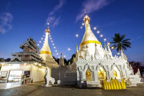
The Mae Hong Son Loop is a classic four-day excursion into the mountains to this remote town, traversing spectacular mountain passes and witnessing some of the best highland scenery in Thailand. There are some pretty towns (with good accommodation) along the way, as well as soft adventure opportunities.
The main roads are paved and decent, and a rented sedan, or even Honda dream motorbike, will be suitable. The true adventurers take off road bikes or a 4×4, though, so they explore some of the back roads to frontier hamlets and remote waterfalls. The entire trip comprises of three, half-day drives, though an additional day to relax in one of the pretty towns is a good idea. The loop takes in some of Northern Thailand’s most popular attractions.
Planning your own journeys can be tricky, as timings are never absolute in Thailand especially during the peak season. It’s a must to check up-to-date information as well as booking in advance. 12Go Asia is a leading transportation search engine in Thailand and Southeast Asia. They are providing e-tickets for trains, buses, ferries and flights.
Going anti-clockwise, you first head north out of Chiang Mai on the 107, before turning left onto the well signposted road to Pai and Mae Hong Son (after about 40kms). Soon the road starts to climb as it winds up the hills, which mark the approach to Huay Nam Dang National Park. For some of the best views on this stretch of road, take a left at Papae and drive five kilometres to Pha Hin, where a lookout point takes in the surrounding valley and 2,000-metre high Mon Angket Mountain. You can also visit the Pong Dueat Hot Springs; one of many on the route.
The road then descends sharply into the Pai valley, which is prettiest in the wet season when it’s covered in wet rice paddy. The town has become very popular over the years as a backpacker hangover, and more recently as a trendy destination for urban Thais. It’s laid-back appeal, charming wooden homestays, cheap bamboo bungalows, and riverside location all add up to a nice surprise. But it does get busy in the high season (end of year). Some of the out-of-town resorts are peaceful.
The next stretch of road is perhaps the most spectacular of the whole loop. No sooner is Pai left behind before the scenery becomes both remote and spectacular, the road turning into a rollercoaster with dramatic views at every turn. This is the very north-westernmost corner of Thailand, between 10-20kms from the Myanmar border. Make sure you stop regularly to take in the views and give the brakes a chance to cool down as you’ll be using them a lot. After passing over a steep saddle, you descend into Soppong (Pang Ma Pha district), which is world famous for its limestone hills and numerous caves. This includes Tam Lod (Cave Lodge), which offers blackwater rafting.
From Pai, it’s about three or four hours to Mae Hong Son (with stops), meaning there should be enough time to check into a guesthouse by idyllic Jong Kham Lake before watching the sun go down over the water. This town is the most remote in Thailand, on a wild frontier of eastern Myanmar, and sits prettily in a valley that is surrounded by hills and often shrouded in mist. There are several temples and viewpoints to visit in this town, along with the tourist magnet of the bizarre long-necked Paduang women, who have brass coils depressing their collar bones.
It’s an early start the next day – ideally around 08:00 – for the long drive south to Mae Sariang. The road here is much less winding, but the scenery still wonderful as the first stretch flanks Mae Surin National Park to the east all the way to Khun Yuam. South of here, numerous rivers criss-cross the road as they flow into the surrounding valleys all the way to Mae La Noi – a bustling little town that makes a worthwhile stop. The last stretch to Mae Sariang (about 35kms farther) takes in the Salawin Wildlife Sanctuary as valleys turn to thick forest on both sides.
The afternoon presents the perfect opportunity for relaxing by the river, in one of several guesthouses fronting this small waterway, or walking around the town. Attractions include the Pha Ma Lo Karen Village, just three kilometres from the town centre, and selling hill tribe handicrafts, particularly fabrics. A number of Buddhist temples are also worth a look, such as Wat Kitti Wong and Wat Uttaranyon, both with strong influences from Myanmar, just 20kms to the west.
The next morning, it’s a three-hour drive back to Chiang Mai via Hod, taking in the Chaem River, Ob Luang National Park and yet more winding hill passes; though the last 100kms back to Chiang Mai is straight highway. You have the option of making a detour into the lovely Doi Inthanon National Park, which includes Thailand’s highest mountain (2,565m) and several impressive waterfalls. There are many resorts at the base and chalets to rent at the park headquarters half way up. A road leads right to the mist-shrouded summit where you will find two modern chedis erected in honour of the King and Queen. Those who are tight on time can skip Mae Sariang by taking the lesser-used road from Khun Yuam to Mae Cham and Doi Inthanon.
